


20240109-venables

doudet
User
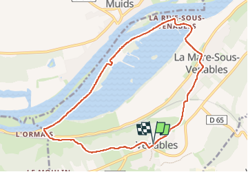

Length
8.9 km

Max alt
130 m

Uphill gradient
157 m
Km-Effort
11 km

Min alt
6 m

Downhill gradient
157 m
Boucle
Yes
Creation date :
2025-01-09 12:30:32.564
Updated on :
2025-01-10 14:18:01.118
2h23
Difficulty : Medium

FREE GPS app for hiking
 SityTrail
IGN / Geographical institutes
SityTrail Plus
The world is yours!
About
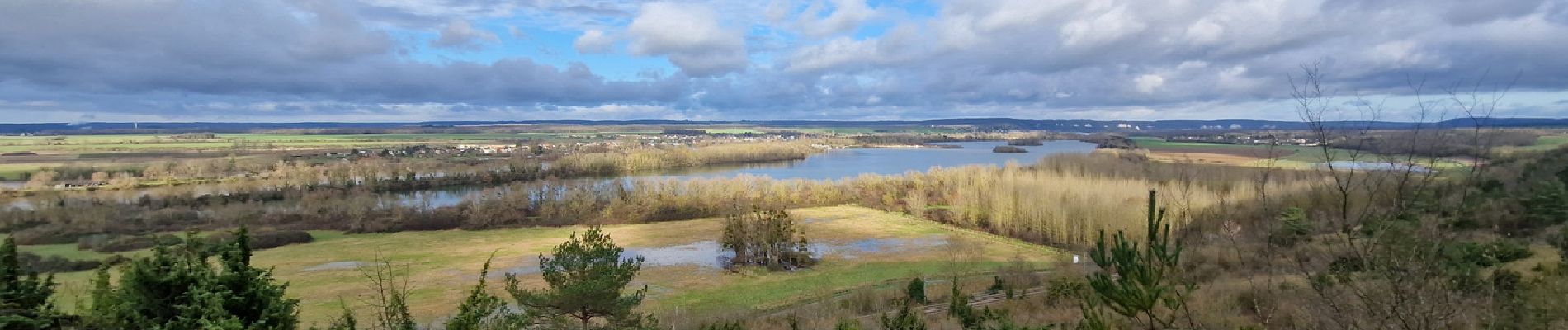
Trail Walking of 8.9 km to be discovered at Normandy, Eure, Les Trois Lacs. This trail is proposed by doudet.
Description
boucle A-R au départ de la Mairie
Photos

Positioning
Country:
France
Region :
Normandy
Department/Province :
Eure
Municipality :
Les Trois Lacs
Location:
Unknown
Start:(Dec)
Start:(UTM)
375896 ; 5451084 (31U) N.
Comments